
Trace a Camden County Street by Address
Use a street directory as a record trail, not a roster. Camden County has 36 municipalities, and a mailing city or ZIP can differ from the incorporated municipality that holds the assessment record. Begin with the full street number, directional prefix or suffix, street type, municipality, ZIP, and unit when one is known. Try alternate abbreviations and an alternate municipal name before deciding an address is missing. The county tax hub and parcel map can identify the assessed owner and the legal parcel; the recorded deed then tests that result against a conveyance. A voter record or historic street listing can add a time-bound person clue, but neither turns the address into a complete household list.
- Search the address in the Camden County myiDV map. Use Street Search to browse a road, Address Search for a number, and Property Card after selecting a parcel.
- Cross-check the parcel in the Property Assessment Data Search Hub. Record the municipality and block, lot, or qualifier rather than relying on the street text alone.
- Use the owner name and legal identifiers in the Clerk's recorded-document search. The purchase deed identifies a grantee and the seller who can be followed backward.
- For a matching person, use New Jersey's individual voter-status route with the county-supplied spelling. A street-wide voter screen was not located, so a statutory county list request is the limited fallback.
- For an earlier household, consult a street or reverse section in the Library or Historical Society directory holdings. Treat each listing as evidence for its publication period, not proof of everyone at the address.
Note: Keep the postal label, municipality, situs address, and parcel identifiers together in search notes so later deed and directory matches can be checked.
Camden County Street Directory Tax Filters
The Board of Taxation's hub is the practical assessor-side start for a Camden County street directory search. Its visible controls let a reader combine Town Filter with Property, Owner Name, and B.L.Q. criteria. It also offers class, Class4, sale-date, sale-price, building-square-footage, and year-built filters. Asterisks stand for any number of characters and question marks stand for one character, which helps test a spelling or street variation. The site is a county-facing view of municipal assessment data; written name and address changes go through the relevant municipal assessor.
| Camden tax-hub field | Format | Use by address |
|---|---|---|
| Town Filter | Municipality dropdown | Narrows an address with a shared postal city. |
| Property | Text or address | Tests the street number or address wording. |
| Owner Name | Text with wildcard guidance | Checks an assessed-owner name found on a parcel. |
| B.L.Q. Filter | Parcel criterion | Connects the result to a block, lot, and qualifier. |
| Sales Date / Price | Date or numeric range | Reduces a broad property result by a transfer window. |
| Building Sqft. / Year Built | Numeric range | Distinguishes similarly named properties. |
The static hub did not expose every parcel-card field, including the exact display labels for mailing address, exemptions, or a sketch. Those details should be verified in a live result or with the municipal assessor. For a full road browse, the GIS Street Search is stronger because the tax hub does not expose a visible street-range control.
Camden County Street Parcel Map Tools
myiDV is the county's street-level discovery tool. It accepts address, owner, PIN, municipal-code/block/lot, and street searches. After a parcel is selected, Mailing Labels or Parcel Profile Report can generate a list of properties within 200 feet, and Property Card can create a report for one or more parcels. The viewer also offers PDF and Excel downloads, a measurement tool, and controls to focus the selected results. A mapped result helps establish which parcels line a road; it is not a legal survey or title proof.
The Camden County GIS parcel-viewer image shows the address, street, owner, PIN, and report tools available for a street search.
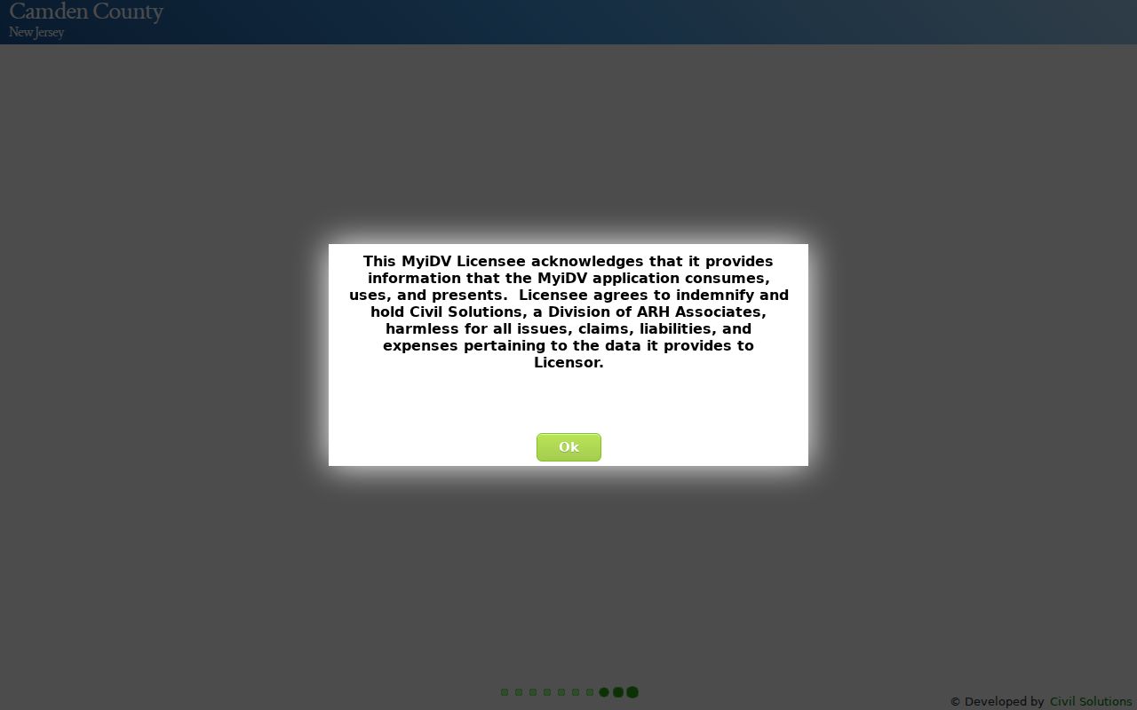
Use the selected parcel's block and lot to hold the street result steady when an older number, road name, or postal label does not match today's address format.
Camden County Street Address Keys
Three address concepts can appear in the same street search and should not be merged. A situs address is where the parcel or building sits. An owner mailing address is where tax correspondence goes, and it may point somewhere else. A legal description identifies the land through a lot, block, subdivision, metes-and-bounds description, or another recorded form. Camden County GIS uses municipal-code/block/lot conventions and can show a PIN. That legal key is often more stable than a street number when tracing a parcel through older documents.
- Parcel
- A defined piece of land in the assessment and mapping system, identified by local parcel details such as municipality, block, lot, qualifier, or PIN.
- Situs address
- The physical location of the parcel or building. It is different from an owner's correspondence address.
- Plat
- A recorded map or subdivision plan that shows lots and their relationship to streets. It can help connect a deed description to a mapped parcel.
- Criss-cross directory
- A reverse or street section that works from an address toward a listed occupant or householder for the year of that volume.
Note: A same-as-situs mailing address may be consistent with owner occupancy, but it is still not proof of who is currently present at the property.
Camden County Street Directory Record Paths
Each address-keyed source answers a narrow question. The assessment record ties an owner and property context to a parcel. GIS expands that point into a street or nearby-parcel view. The Clerk's index supplies recorded transfers, while historic directories and telephone books provide dated listing clues. Municipal building and code records can date an improvement or government action at a property, but Camden County has no single countywide permit portal. The table keeps those paths separate so a street directory result is not overstated.
| Address source | Camden County path | Contribution | Limit |
|---|---|---|---|
| Tax assessment | taxdatahub property, Town, or B.L.Q. filters | Assessment, owner, sale, and property context | Not every parcel-card field was visible in static output. |
| GIS parcel map | myiDV address, street, owner, PIN, or block/lot | Street discovery, parcel map, card, and 200-foot set | Spatial evidence, not survey or title proof. |
| Recorded deed | Clerk NewVision party, town, legal, date, or lot/block search | Conveyance and document chain | Public web coverage begins in 1978. |
| Voter status or list | Exact-name tool or statutory county request | Registered name, address, status, and jurisdiction where available | No universal street interface; protected addresses are withheld. |
| Building or code file | Municipal office, Camden CORA, or OPRA route | Address-specific work, applicant, owner, or action clues | Local, not countywide. |
| Street directory / telephone book | Library or Historical Society street sections | Historical listed occupant or subscriber clue | Runs have municipal and year gaps. |
Start with the parcel identifiers, then move to the recorded document and only then to a person-specific source. That order prevents a commonly named owner or a similar address from being attached to the wrong property.
Deeds Behind Camden County Streets
The Camden County Clerk's SearchAnywhere view supports party name, second party, document type, town, date range, consideration, lot/block, book and page, clerk file number, legal, and linked-document searches. Search the present tax owner as a grantee, then use the seller from that deed as the next earlier grantee. Match the legal description and block/lot at each handoff. Linked records can expose supporting mortgages, assignments, releases, liens, or cancellations, but they do not establish a list of everyone who stayed at the address.
The Camden County recorded-deed search image shows the fields used to narrow a street-linked document result.
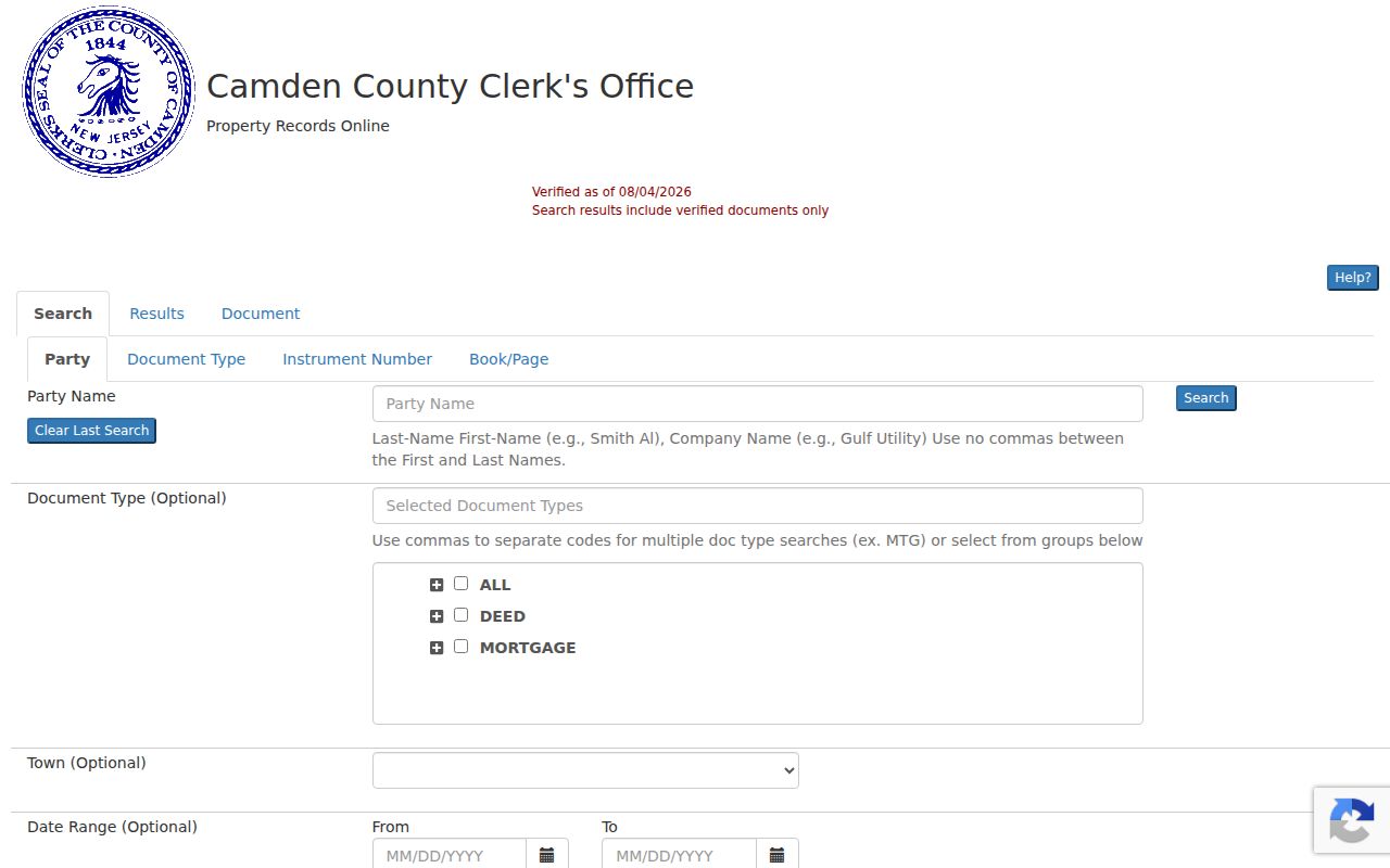
NewVision asks users to try spelling variants. Use last-name-first-name formatting for people where the search instructions call for it, and test an alternate surname form before treating a party search as empty.
Camden County Deed Records Before 1978
Camden County's online official-record index begins January 1, 1978 and is updated nightly. Basic access is free without an account and provides watermarked, unofficial copies of primary documents such as deeds, mortgages, discharges, and cancellations. The premium tier is listed at $25 per month and reaches additional document classes and copies without that watermark. For a street directory search that crosses the web cutoff, use the Clerk's counter and deed books, New Jersey State Archives microfilm through 1900, FamilySearch digitization of Camden deeds for 1844 to 1901, or the Historical Society's original and duplicate deed resources.
The 1978 web cutoff matters because a search that appears to begin then may reflect the portal's coverage rather than the first transfer of the parcel. Camden County deeds begin with the county in 1844; earlier land records belong to Gloucester County. The Clerk's online-property-records page describes the free and premium paths, while the State Archives supplies a microfilm and archival route.
The Camden County Property Alert image documents the Clerk's free email-notification option for names or municipality/block/lot registrations.
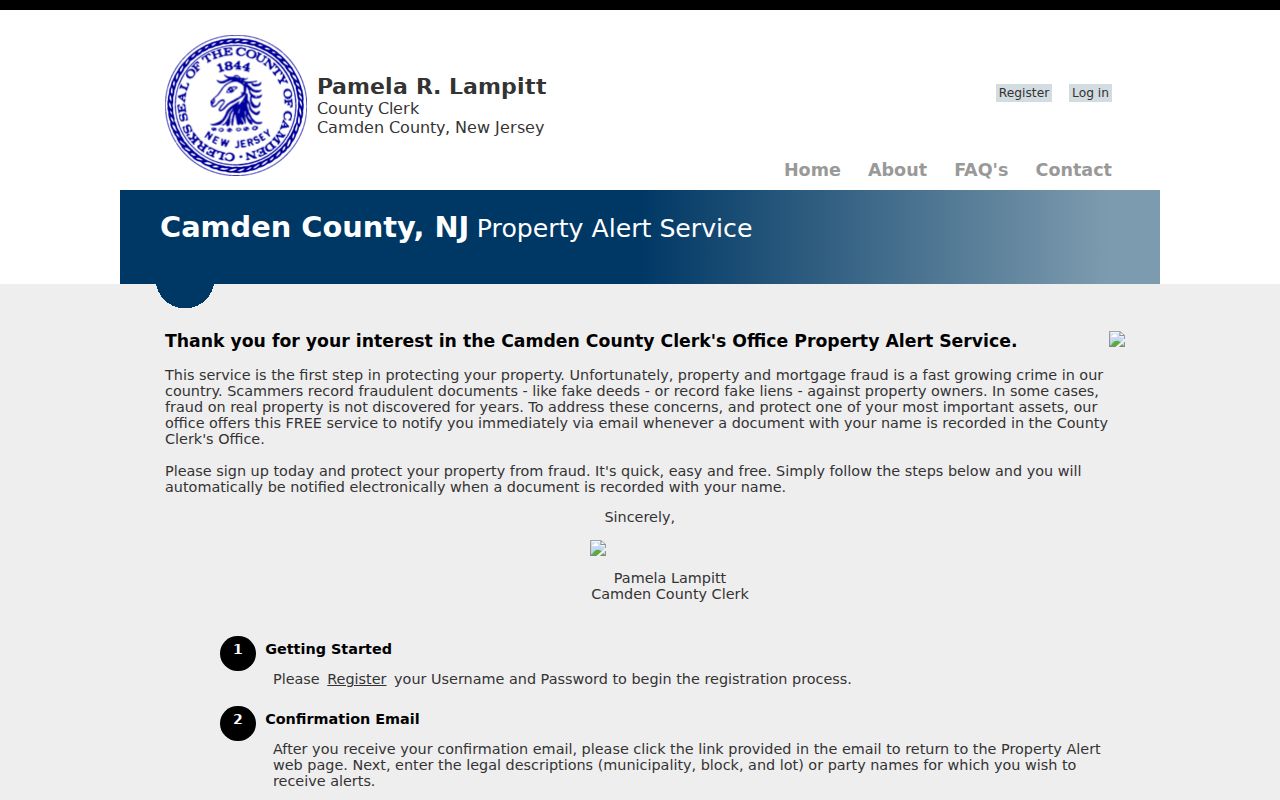
Register each name variation separately for an alert, such as a name with a middle initial and its expanded version. The service monitors future recordings; it does not reconstruct a past street history.
Note: The Clerk is at Room 102, 520 Market Street, Camden, and lists Registry Division access by counter, phone, and online portal for records research.
Voter Status on a Camden County Street
New Jersey's Voter Registration page links the individual “Am I Registered?” search. Use the name exactly as the county supplied it. Hyphens, spaces, marriage-name changes, middle initials, and nicknames can change a result, so McDonald and Mc Donald may need separate attempts. A matching record can be a useful date-specific registration clue, but it does not prove that all people connected to the address are listed or that a person currently remains there.
No public screen for all voters on a Camden County street was located. Under N.J.S.A. 19:31-2, a voter may request a computer-generated or electronic list for election districts in the county, subject to the statutory cost ceiling and protected-address rules. The list cannot be used as a basis for commercial or charitable solicitation. Use county election maps to connect a parcel to its municipality, ward, and district, and never infer a ballot choice from party or participation information.
Camden County Historic Street Listings
For who lived here before, a reverse or street section can turn a house number into a listed name for the year a volume was compiled. The Camden County Historical Society holds Camden City directories for most years from 1839 to 1947, and the Camden County Library has 25 reels covering 1863 to 1947 with named gaps. The Society also reports Camden telephone books for most years from 1921 to 1998. These are historical address tools, not a substitute for the current street-by-street property chain. The historical collections themselves are detailed on the Camden County city directory page.
An older Camden street can have evidence beyond a single directory line. The Historical Society keeps owner-labelled maps and atlases for 1856, 1877, 1886, 1902, 1907, and later Camden map runs, while its local tax ledgers include incomplete Camden City volumes from 1850 to 1938. A 1906 Library of Congress Sanborn volume has 79 sheets. Maps and ledgers can show building or land context, but they are not resident lists.
Note: A missing name may reflect a directory gap, a rural or municipal coverage boundary, an omitted person, or the date of compilation, not a conclusion about absence.
Camden County Street Records by Municipality
Permits and code cases stay local in Camden County. Camden City Building Bureau materials use email applications and written inspection requests, and Camden CORA can search addresses, street names, or ordinances. For the other municipalities, use the relevant building or code office and its local public-records route. The county municipality directory is the correct first stop when a street crosses a postal or municipal boundary. N.J. Open Public Records Act requests, N.J.S.A. 47:1A-1 et seq., must go to the right custodian and can be subject to exemptions or redactions.
Permit and code material can identify a project, a date, an applicant, an owner, or a contractor. It does not provide a universal countywide address directory. Keep the record type and municipality in the research note so an address-based result is not presented as a resident claim.
Limits of a Camden County Street Directory
An assessed owner is not a complete list of people at a parcel. A voter result concerns registrants, not everyone associated with the address, and protected participants may have a withheld or substitute address. A 200-foot report is a nearby-parcel tool, not a people list. New Jersey MVC driver and vehicle address information has controlled written-request and identification rules under the Driver's Privacy Protection Act, while utility and delivery customer lists were not located as casual public address sources. Keep each document in its proper lane and verify an important result with the custodian.
Lawful use. Camden County street and property records are for personal, lawful research, family history, estate questions, and consumer safety. Do not use an address result to stalk, harass, intimidate, or harm anyone.